Go Back 30,000 Years watershed map
Go Back 30,000 Years: Design Specifications and the Forces of Geologic Change
"Architecture at its best, traces, crystallizes and makes visible the instabilities of geologic time in the time and materials of human experiences" - Aaron Betsky, "Instability" (1)
Our photographic tale investigates a very particular potential within the imaginations of publics and urban planners. It attempts to evolve new capacities to creatively imagine the material reality of Great Lakes' geologic forces. It presents those forces as not locked in the past, but as still in process, directly shaping work and daily life.
The story of the urbanization of the Great Lakes Mega region is part of a much vaster tale. This tale spans a length of time that exceeds human comprehension. It is propelled by relentless changes that are monumental in force: volcanic eruptions, continent sized glaciers, continental rifts, shallow inland seas, catastrophic floods, and overthrusts of planetary crust riding atop tectonic plates.
The actors in this story may seem distant in time. But the otherworldly force of monumental geologic change continues to inflect daily life. Here and now, the earth continues to rebound from the weight of the last ice age. Here and now, the remnant of a continental rift accommodates a lake containing 10% of the Earth's fresh water. Right now, geologic forces are transforming the region into next stages and events—into worlds to come.
Powerful and mysterious forces of geologic change imbue these bodies of water. While the transformations they bring are vast and relentless, they are often at a scale and at a rate that is imperceptible to humans. And, our habitual ways of experiencing recreation, urban planning, economic exchange, trade, transport, and water consumption often make it difficult to sense their reality. If seen at all, geologic force is often experienced as peripheral to common cultural perceptions about what constitutes The Great Lakes. This may seem to render the geologic peripheral to the work of architects, engineers, and planners. But, in fact, geologic forces and materialities shape human experience, environments and activities in the Great Lakes Basin continuously and directly. The geologic delimits the region's ecological, hydrological and historical development patterns. Now and then, the pace of geologic change quickens, allowing human time and geologic time to intersect in the form of events such as floods, landslides, sinkholes and earthquakes. At such moments, the geologic erupts into human awareness and becomes palpable as a contemporary force.
Our project was to make geologic forces of the Great Lakes visible and contemporary. Through photographic tale and speculative narrative, we documented a research trip to the periphery of the region. Our aim was to feel for ourselves the geologic forces that continue to shape the contemporary Great Lakes. Our imaginative investigation focused on a practice that speaks directly to designers, architects, and regional planners: the definition of design specifications. While in the field, we sought out sites where we might sense and perceive specific geologic forces. We creatively documented the material traces of the forces we experienced. We used our documentation as inspirational data for our speculations. We staged an encounter between design specifications and the forces of geologic change. What new ways of designing and planning in relation to the forces that compose the Great Lakes Region might such an encounter make possible and thinkable?
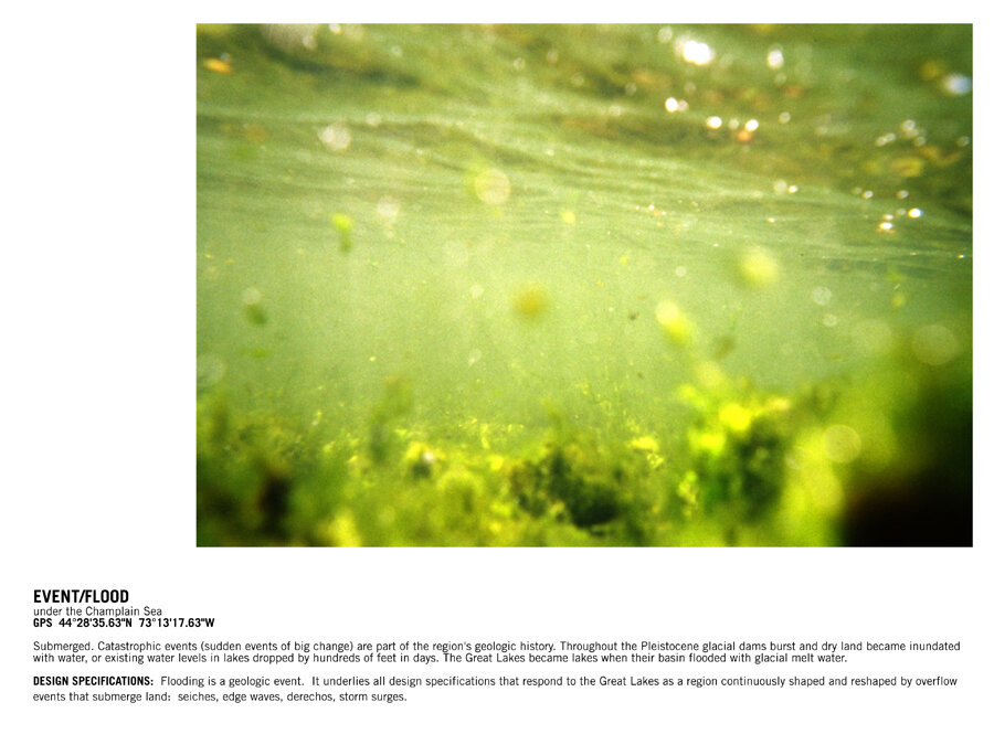
Our imaginative investigation took us to the periphery of time and space—to the Wisconsin glaciation 70,000 to 10,000 years ago, and to the ancient shores of Pleistocene Champlain Sea. The Champlain Sea (existing between 13-10,000 years ago) is the Pleistocene predecessor of its contemporary remnant, Lake Champlain. Lake Champlain is "between" the borders of New York, Quebec and Vermont. In 1998, Congress declared Lake Champlain to be the sixth Great Lake—a status it enjoyed for only 18 days before it was revoked.
We chose Lake Champlain for our field research because, as a sixth Great Lake, it acts as a provocation to our geologic imaginations. Though Lake Champlain exists on the periphery of the Great Lakes region today, when viewed through geologic force and time, its connections and contributions to the Great Lakes-as-system are unmistakable.
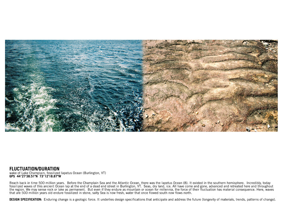
During the late Pleistocene, the Champlain Sea existed as a vast inlet of the Atlantic Ocean. Its ancient shorelines are visible today in the hills that surround towns such as Burlington, Vermont. Fossils from ancient sea life and skeletons of beluga whales greet visitors at museums in the area.
During the Pleistocene, precursors to the Great Lakes existed to the west: glacial Lake Minong (present day Lake Superior), Lake Iroquois (present day Lake Ontario), Lake Warren (present day Lake Erie), an ancestral Lake Michigan, and a low-lying depression through which flowed the now-buried Laurentian and Huronian Rivers (present day Lake Huron).
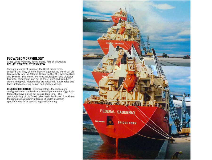
The contemporary lakes Champlain, Superior, Michigan, Huron, Ontario, and Erie, are deeply interconnected by the same origin story: all were created by glacial melt waters of the Wisconsin glaciation’s retreat.
The need to evolve cognitive capacities to design for deep time is urgent. We are at a moment in human history when the fabric of human life depends on extractions of rapidly depleting geologic materials that took millennia to form. This is also a moment when human actions have created waste materials whose “geologic layer” will most likely outlast our species. Projects are underway that will affect the ecologies and geologies of the Great Lakes region, possibly for thousands of years to come and in ways unknowable from here.
Our project invites publics, designers, engineers and architects to approach their work with a palpable sense of the power, scale and dynamics of the region's geologic forces.
Our photographic tale is punctuated by two-word neologisms. Each pairs a sensation or process of geologic force with a geologic materiality that shapes the Great Lakes region.
REFERENCES:
1) Land&ScapeSeries: Landscape + 100 words to inhabit it, Colafranceschi, D., Barcelona: Gustavo Gili, 2007
2) “The Basin,” Lake Champlain Basin Program, Fact Sheet Series, number 3, 1999
3) Apparent Vertical Movement Over the Great Lakes - Revisited, Report prepared by The Coordinating Committee On Great Lakes Basic Hydraulic and Hydrologic Data, Geodetic Survey Division of Natural Resources Canada, November, 2001
4) “Geoscape Ottawa-Gatineau, Landslides,” Natural Resources Canada
5) ”Quebec Family Dies as Home Vanishes Into Crater,” Jan Austen. May 12, 2010, New York Times
6) Progress Report for Geotechnical Study of the Jeffersonville Landslide, Northwestern Vermont, 2009, Laurence Becker, George Springston, Leslie Kanat, September 24, 2009
7) Jeffersonville Landslide, Vermont Geological Survey
8) “Nature of the Basin, Lake Champlain Basin Atlas,” Geology of the Basin
9) The Anthropocene, coined by Paul Crutzen in 2000. The more recent geologic era marking significant impact by humans upon the planet's ecological systems, and the New World of the Anthropocene, Environmental Science and Technology, 2010
10) Onkalo, Finland is the world's first geologic repository for the storage of nuclear waste. The facility's design specifications require it to withstand the pressure and impact of returning ice and rising sea levels equal to that of the Pleistocene.


